
 Armenian
 German
 Spanish
New Zealand keeps its finest sights at the end of long roads. Expect empty highways, sheep on the road and single-lane bridges. Most of what you came for was made by ice, fire and water, so the cities can wait. This route runs from the far south to the far north.
Milford Sound
The road to Milford is part of the visit. From Te Anau, about 120 kilometres away, it climbs through beech forest to the Homer Tunnel, a single lane bored through the mountain and run by traffic lights. Keas, the cheeky mountain parrots, work the queue and will happily chew a windscreen wiper.
On the other side, the cliffs close in. Milford Sound, Piopiotahi in M?ori, is a fiord carved by ice, and Mitre Peak rises 1,692 metres straight out of the water. Locals say it looks best in a downpour, when hundreds of waterfalls appear on the rock walls and vanish within hours. On the boat out to the Tasman Sea, look for fur seals asleep on the ledges.
The Glaciers
On the West Coast, the Franz Josef and Fox glaciers come down from the Southern Alps almost into the rainforest. Both have shrunk fast, and you can no longer walk onto the ice. Take the valley trails, or a helicopter up to the snowfields. The two glacier villages are about half an hour apart by road. On a windless morning, nearby Lake Matheson reflects Aoraki and Mount Tasman.
Aoraki / Mount Cook
Aoraki / Mount Cook is the highest mountain in the country at 3,724 metres, and for the Ng?i Tahu people it is an ancestor. The Hooker Valley Track crosses three swing bridges to a lake where small icebergs float below the summit. It takes about three hours there and back (check track alerts beforehand, as storms occasionally close the upper bridges).
Lake Tekapo is an hour away. Glacial rock flour turns its water a milky turquoise that looks fake in photographs. The little stone Church of the Good Shepherd sits on the shore. The whole basin is an international dark sky reserve, so stay up late.
Kaik?ura
Kaik?ura lies about two and a half hours north of Christchurch. On the east coast, a deep undersea canyon comes close to land and draws sperm whales all year. Boats leave most mornings when the sea allows.
Abel Tasman
At the top of the South Island, the coast turns gentle, with golden beaches and clear coves along a famous coastal track. Rent a kayak for a day and paddle from one to the next. Marahau, the main gateway, is about an hour's drive from Nelson.
Tongariro
Tongariro became New Zealand's first national park in 1887, after the Ng?ti T?wharetoa chief Te Heuheu T?kino IV placed its sacred peaks in the care of the nation.
The Tongariro Alpine Crossing is often called the best day walk in the country, and it is a serious one. Over about 19 kilometres, you climb past steaming vents to the rim of the Red Crater, then slide down loose scree to the Emerald Lakes. Most people need six to eight hours. Mount Ngauruhoe stands beside you most of the way. The weather can turn in minutes, so start early and carry warm layers, even in summer.
Rotorua
You smell Rotorua before you see it. The town lies about three hours south of Auckland, on one of the most active geothermal fields on Earth. At Te Puia, the P?hutu geyser erupts several times a day, sometimes up to 30 metres high. In Whakarewarewa village, M?ori families still cook in the natural steam. Stay for an evening of kapa haka, the M?ori art of song, dance and chant. South of town at Waiotapu, minerals stain the pools acid orange, green and yellow.
Hobbiton
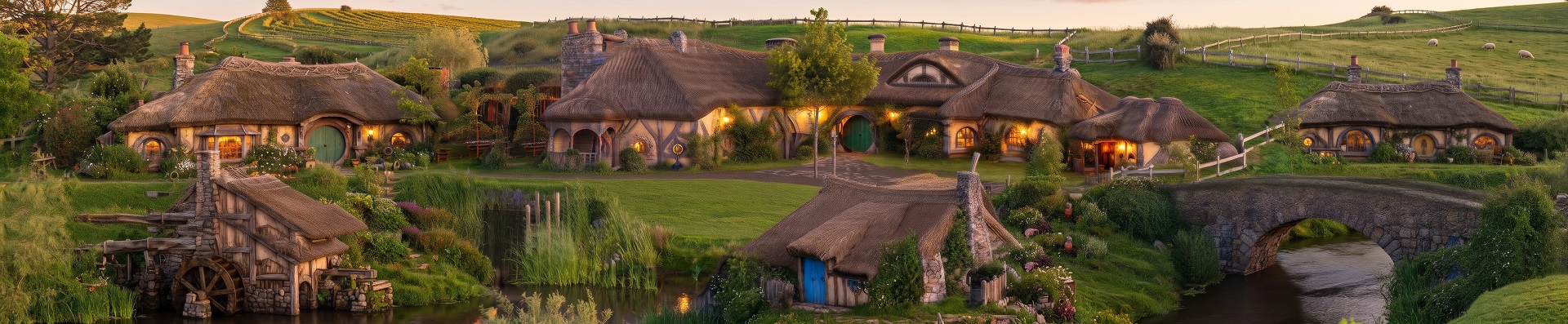
Near Matamata, the village built for The Lord of the Rings and Hobbit films still stands on a working sheep farm, with 44 hobbit holes and the Green Dragon Inn included. It is about two hours from Auckland. Book ahead in summer.
Waitomo Caves
Under the farmland of the King Country, a little over an hour from Hobbiton, thousands of glowworms live on the ceilings of limestone caves. In the Glowworm Grotto, a guide pulls the boat along a rope in silence and total darkness, and the blue lights slowly appear overhead. For something wetter, blackwater rafting takes you down the underground rivers on an inner tube.
Waitangi
The route ends in the subtropical north, about three hours from Auckland, where the Bay of Islands holds about 144 islands in calm water. On its shore are the Waitangi Treaty Grounds. Here in 1840 the British Crown and M?ori chiefs signed the Treaty of Waitangi, the founding document of the country. Down by the water, the ceremonial war canoe Ng?tokimatawhaorua, built for more than 70 paddlers, goes back on the water every 6 February, on Waitangi Day.
Magelline Perspective
When Abel Tasman reached these islands in 1642, he sailed along the coast for a few weeks and never went ashore. At Magelline we often see travellers repeat his mistake and try to see the whole country in a week. Wait out the rain at Milford. Stay up for the stars at Tekapo. Walk the Tongariro Crossing on a clear day, even if you have to wait for one. That is how we plan New Zealand routes at Magelline: fewer stops, longer stays, and room for the weather to change its mind.
